

File:Mauretania et Numidia.jpg

Size of this preview: 800 × 315 pixels. Other resolutions: 320 × 126 pixels | 640 × 252 pixels | 1,024 × 404 pixels | 1,280 × 504 pixels | 3,509 × 1,383 pixels.


Original file (3,509 × 1,383 pixels, file size: 494 KB, MIME type: image/jpeg)

Summary
Nederlands: Uit: H.Kiepert, Atlas antiquus, Berlin (Reimer) o.J.
Bron: https://www.gottwein.de/latine/map/imp01_afr_nw.jpg
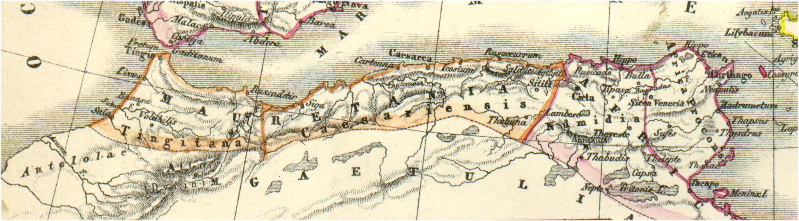
Español: Mapa de las provincias romanas de Mauritania Tingitana, Mauritania Cesariense y parte de Numidia, en el norte de África.
Autor: H.Kiepert, Atlas antiquus, Berlin (Reimer) o.J.
Licensing

|
This work is in the public domain in its country of origin and other countries and areas where the copyright term is the author's life plus 70 years or fewer.  You must also include a United States public domain tag to indicate why this work is in the public domain in the United States. You must also include a United States public domain tag to indicate why this work is in the public domain in the United States.
|
| This file has been identified as being free of known restrictions under copyright law, including all related and neighboring rights. | |
File history
Click on a date/time to view the file as it appeared at that time.
| Date/Time | Thumbnail | Dimensions | User | Comment | |
|---|---|---|---|---|---|
| current | 16:54, 3 January 2011 | | 3,509 × 1,383 (494 KB) | wikimediacommons>Profburp | Meilleure définition. Extrait de la carte: Hispania, Mauretania et Africa. (with) Carthago. (with) Provinciae Carthaginiensibus subditae. Auctore Henrico Kiepert Berolinensi. Geographische Verlagshandlung Dietrich Reimer (Ernst Vohsen) Berlin, Wilhemlstr |
File usage
The following page uses this file:
